

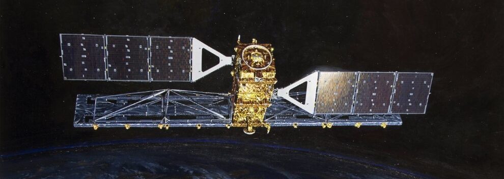
The Canadian Space Agency’s (CSA) Remote Sensing satellite (RADARSAT-1), which stopped transmitting because of a technical anomaly in March 2013, was equipped with synthetic aperture radar (SAR), a powerful microwave instrument. It transmitted and received signals to capture high-quality images of the Earth night and day and in all weather conditions. RADARSAT-1’s SAR transmitted a microwave energy pulse (C-band at 5.3 GHz frequency) to Earth, and the SAR measured the amount of energy reflected back to the satellite from the Earth’s surface.
The RADARSAT-1 SAR instrument was able to shape and steer its radar beam using C-band. A wide variety of beam widths were available to capture swaths of 45 to 500 kilometers, with a range of 8 to 100 meters in resolution and incidence angles of 10 to 60 degrees.

Data Products
- SAR — synthetic aperture radar
- 1995-2008
- Worldwide coverage, with extensive coverage of Arctic Ocean sea ice
- Datapool contains ASF standard beam odd frames, as well as the first and last frame of each imaged swath
- Datapool contains all Fine Beam 1 frames
- CEOS — Level 0 and Level 1 framed
- Level 0 (raw data)
- Level 1 (amplitude image)
- Left-looking
- Antarctica mosaics — open access
Coverage Maps
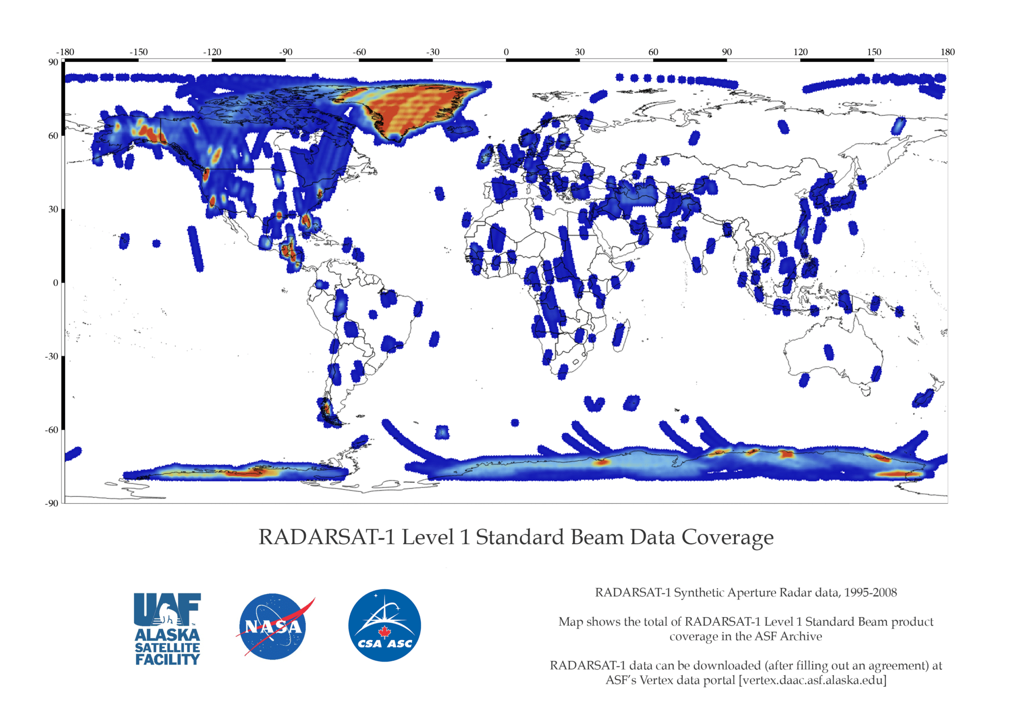
RADARSAT-1 Level 1 Standard Beam Data Coverage
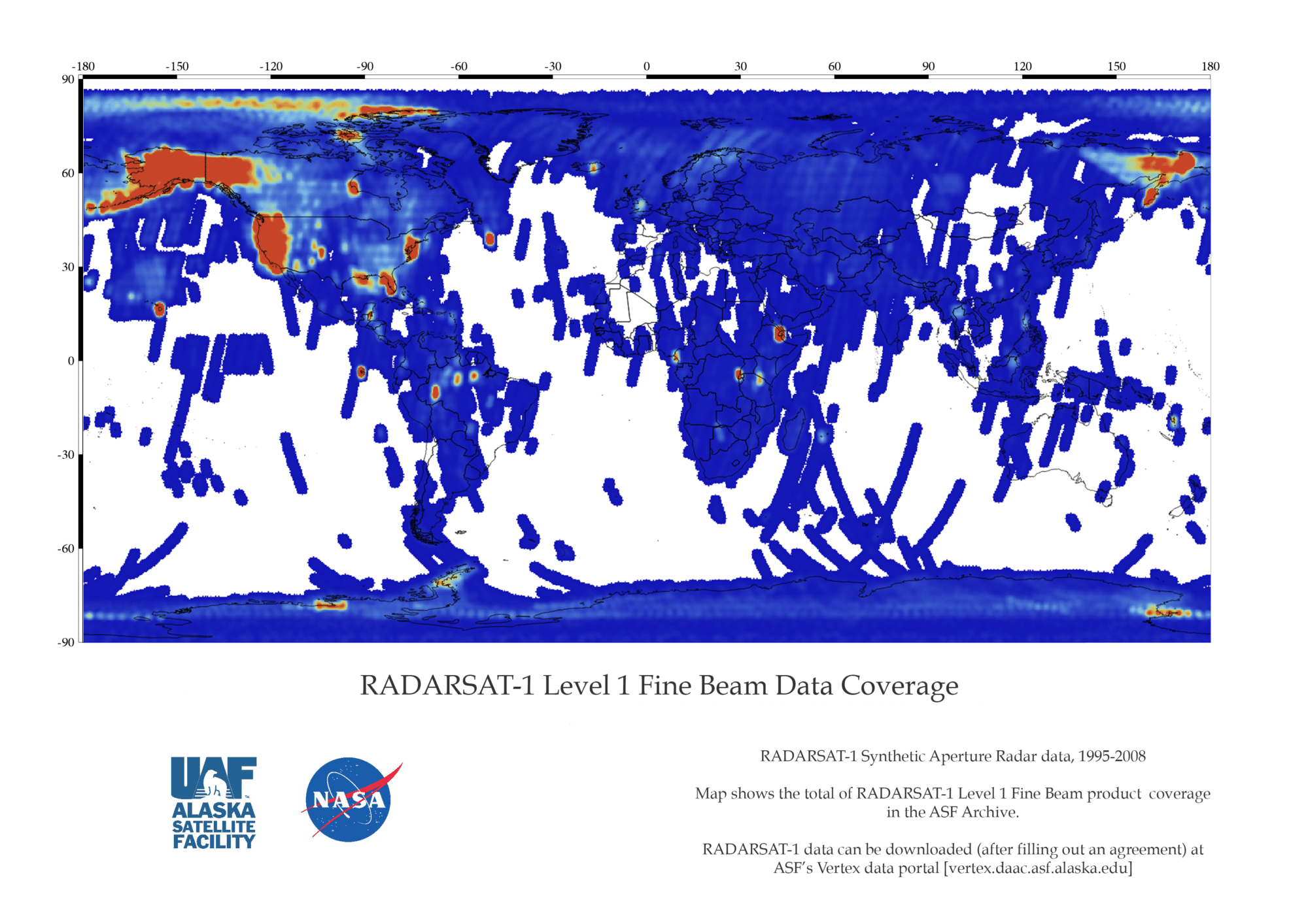
RADARSAT-1 Level 1 Fine Beam Data Coverage
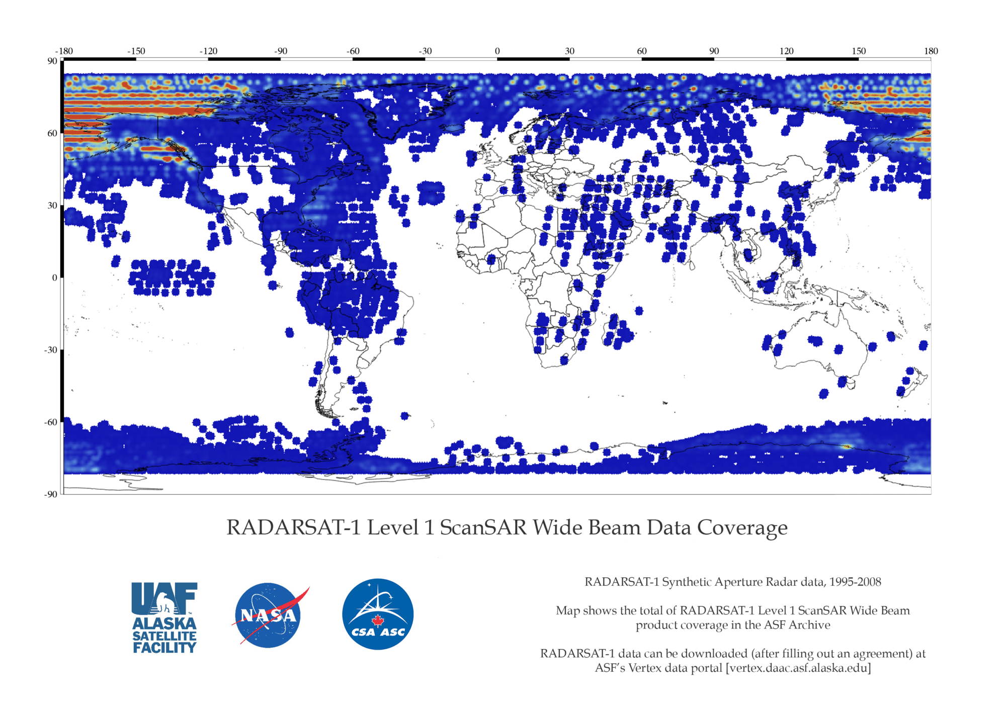
RADARSAT-1 Level 1 ScanSAR Wide Beam Data Coverage
Radarsat-1 Technical Specs
| Fine Mode | Standard Mode | ScanSAR Mode | |
|---|---|---|---|
| Frequency/wavelength | 5.3 GHz/C-band 5.6 cm | ||
| Polarization | HH | HH | HH |
| Range Resolution | 8 m | 30 m | 50-100 m |
| Swath Width | 45 km | 100 km | 300-500 km |
| Off-Nadir Angle | 37-47° | 20-49° | 20-49° |
How to Cite Data
Cite data in publications such as journal papers, articles, presentations, posters, and websites. Please send copies of, or links to, published works citing data, imagery, or tools accessed through ASF to [email protected] with “New Publication” on subject line.
How to Cite Imagery
Include credit with each image shown in publications such as journal papers, articles, presentations, posters, and websites. (NASA does not copyright imagery.)
| Format | Example |
|---|---|
| © CSA [year of data acquisition] | © CSA 2002 |
RADARSAT-1 Datasets and DOIs
| Sample ID | Heading 1 |
|---|---|
| L0_RADARSAT-1 | 10.5067/GXBUNGIGEOO3 |
| L1_RADARSAT-1 | 10.5067/KUIX1CRFDW44 |