

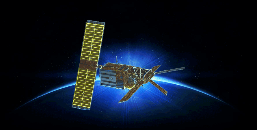
ERS-1 SAR Data
NASA’s provision of the European Space Agency’s (ESA) European Remote Sensing satellites (ERS-1 and ERS–2) Synthetic Aperture Radar (SAR) data archive via the ASF DAAC is now free and open by agreement between NASA and ESA. As part of the Earth observation Heritage Data Program (LTDP+), the ERS-1 and -2 missions provide scientists with historically accurate and easily accessible information to help further understand the dynamics of our planet.
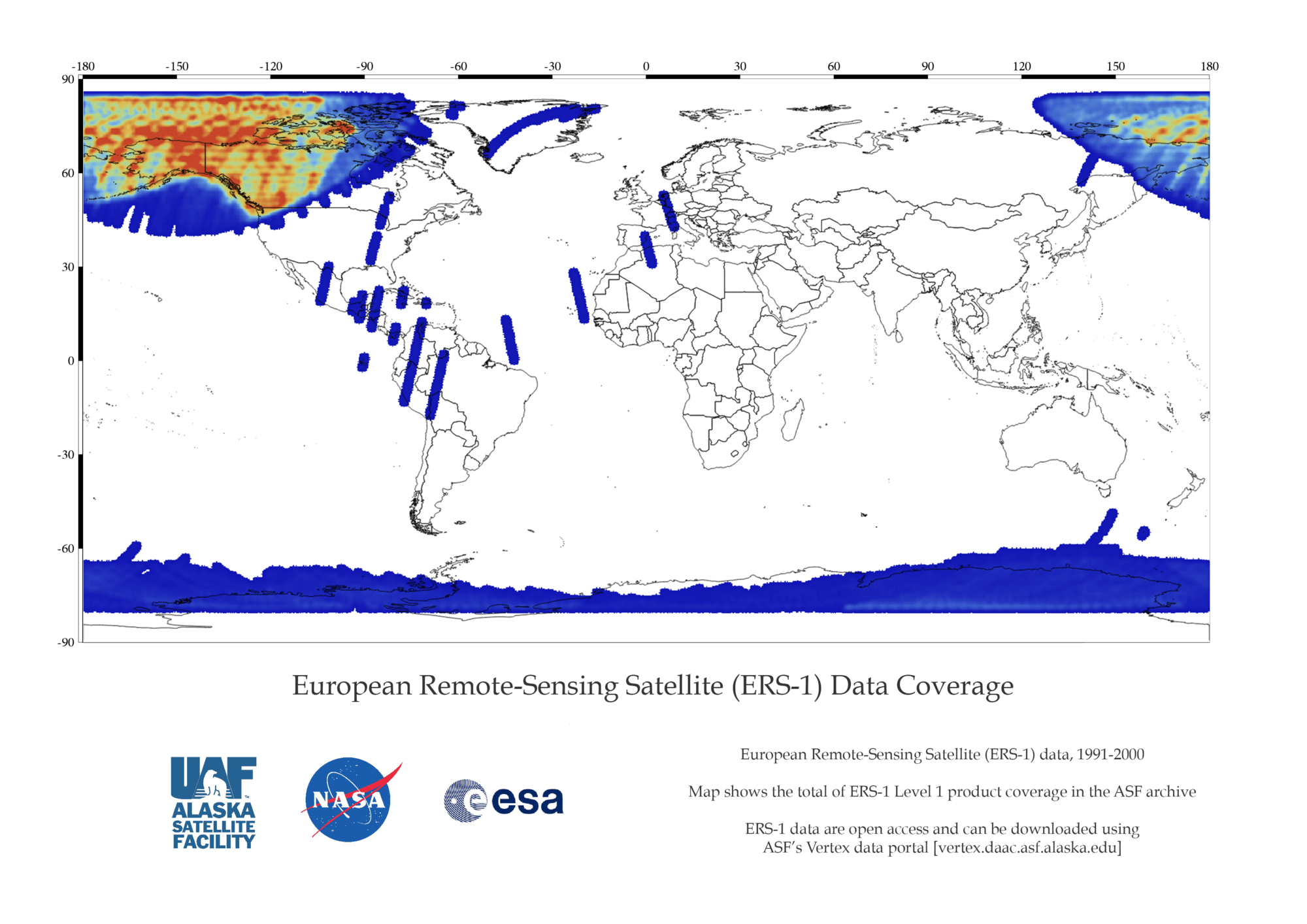
ASF holds a subset of all ERS data — primarily data downlinked from the ASF and McMurdo satellite tracking ground stations.
Coverage Map of ERS-1 Data in the ASF Archive

Dataset Description:
- SAR — synthetic aperture radar
- 1991-2000
- Primarily imagery within the ASF and the McMurdo, Antarctica, station masks
- Datapool contains ASF standard beam odd frames, as well as the first and last frame of each imaged swath
- Flew in tandem with ERS-2 for 9 months in 1995/1996; data suitable for interferometry
Data Format:
- CEOS — Level 0 and Level 1 framed
Downloadable Products:
- Level 0 (raw data)
- Level 1 (amplitude image)
ERS-1 Technical Specs
ERS synthetic aperture radar (SAR) provides high resolution, two-dimensional images. Image data was acquired for a maximum duration of approximately 10 minutes per orbit.
| Standard Mode | |
|---|---|
| Frequency/wavelength: | 5.3 GHz/C-band 5.6 cm |
| Polarization: | VV |
| Spatial Resolution | 26 m in range (across track) Between 6 m and 30 m in azimuth (along track) |
| Swath Width | 100 km |
| Off-Nadir Angle | 21° |
Mission Phases
The ERS-1 and ERS-2 mission phases are listed below. For more information on each phase, see the Delft University of Technology website, which retrieved the information originally from ESA/ESRIN:
ERS-1
A. Commissioning Phase: 25-Jul-91 to 10-Dec-91
B. Ice Phase: 28-Dec-91 to 30-Mar-92
R. Roll Tilt Mode Campaign: 4-Apr-92 to 13-Apr-92
C. Multidisciplinary Phase: 14-Apr-92 to 21-Dec-93
D. Second Ice Phase: 23-Dec-93 to 10-Apr-94
E. First Geodetic Phase: 10-Apr-94 to 28-Sep-94
F. Second Geodetic Phase: 28-Sep-94 to 21-Mar-95
G. Tandem Phase: 21-Mar-95 to 5-Jun-96
ERS-2, 29-Apr-96 to 5-Sept-2011
ERS-2 had one multi-disciplinary phase planned, but in early 2011, ESA changed the satellite orbit so SAR images of the Antarctic could be recorded with the same viewing angle every three days rather than every 35 days.
ESA ERS-1 and ERS-2 End User License Agreement
Data provided by the ERS-1 and ERS-2 missions are available in an open and non-discriminatory way, and distribution of the data shall be consistent with United Nations Resolution A/RES/41/65 dated 3 December 1986 on Principles Relating to Remote Sensing of the Earth from Space.
ESA does not guarantee the suitability of ERS-1 or ERS-2 data for the purpose of a project and shall not be held liable for any damage derived from the use of such data by the user.
The acceptance of these Terms and Conditions will authorize full access using Vertex to the ERS-1 and ERS-2 datasets at ASF DAAC.
I acknowledge and agree to respect the full title and ownership by ESA of all ERS-1 and ERS-2 data.
I agree to clearly mark all ERS-1 and ERS-2 data, irrespective of the form in which it is reproduced, in such a way that the data credit or image copyright are clear to see.
Data: Dataset: ERS-2[1], ESA [year of data acquisition]. Downloaded from ASF DAAC [day/month/year of data access].
Images: © ESA [year of data acquisition]
How to Cite ERS-1 Data Retrieved from ASF DAAC
Cite data in publications such as journal papers, articles, presentations, posters, and websites. Please send copies of, or links to, published works citing data, imagery, or tools accessed through ASF to [email protected] with “New Publication” on subject line.
How to Cite ERS-1 Imagery
Include credit with each image shown in publications such as journal papers, articles, presentations, posters, and websites.
| Format | Example |
|---|---|
| © ESA [year of data acquisition] | © ESA 1993 |