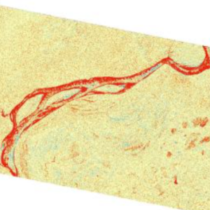
This new tutorial demonstrates the process of using synthetic aperture radar (SAR) for visualizing changes in a landscape caused by distrubances such as floods, deforestation, agriculture, and freeze/thaw cycles.
It utilizes Sentinel-1 radiometric terrain corrected (RTC) SAR products created by the JPL OPERA Project and GIS software to detect differences in the backscatter signals of two images acquired over an area separated in time — before and after an event.
The tutorial steps through the process of searching for and downloading OPERA RTC data from ASF. Then it describes workflows for importing the data into ArcGIS or QGIS and performing change detection analysis.
While the workflows described in the tutorial use OPERA RTC-S1 burst products, the same workflows can be applied to Sentinel-1 frames processed using the ASF HyP3 On Demand service. This allows for studying a larger area than that covered by a single burst.
Explore Change Detection using OPERA Sentinel-1 RTC here:
https://storymaps.arcgis.com/stories/4f7ab712e40346809597b4ae8fd641ca


