

Seasat Satellite's Synthetic Aperture Radar: History and Tech Specs
1978 Landmark in Remote-Sensing History
On June 27 GMT, 1978, NASA undertook a momentous task: launching the Seasat satellite in order to demonstrate the feasibility of orbital remote sensing for ocean observation. On board was the first NASA synthetic aperture radar sensor ever deployed.
This mission supplied the decades-old data that the Alaska Satellite Facility, a NASA Distributed Active Archive Center (DAAC), has processed into a treasure trove of digital images. The new imagery enables scientists to travel back in time for research on oceans, sea ice, volcanoes, forest land cover, glaciers, and more. Before now, only a small percentage of Seasat data was processed digitally.
Although Seasat suffered a catastrophic power failure on October 10, 1978, in 106 days the satellite collected more synthetic aperture radar information about the ocean surface — its primary mission — than had been acquired in the previous 100 years of shipboard research.
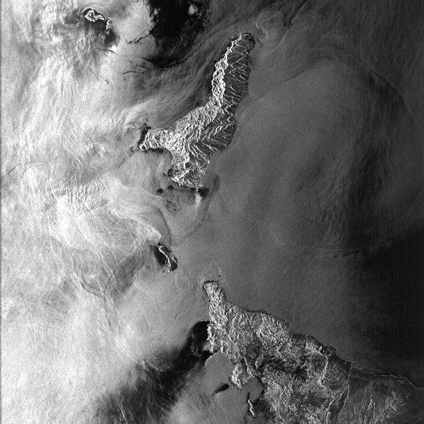
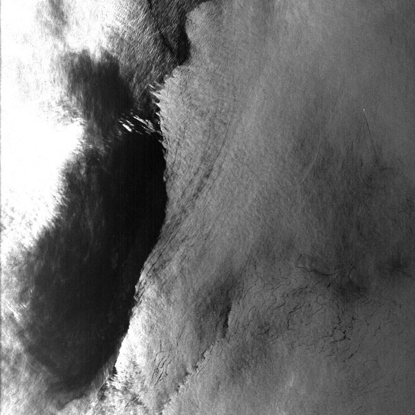
Synthetic aperture radar, also known as SAR, bounces a microwave radar signal off the surface of Earth to detect physical properties. Unlike optical photo technology, SAR can see through darkness, clouds, and rain.
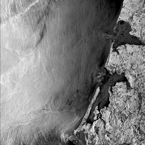
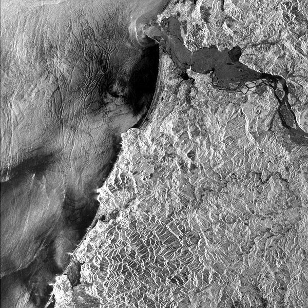
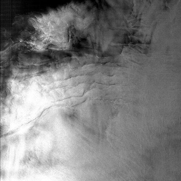
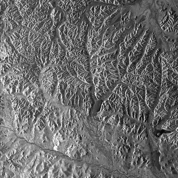
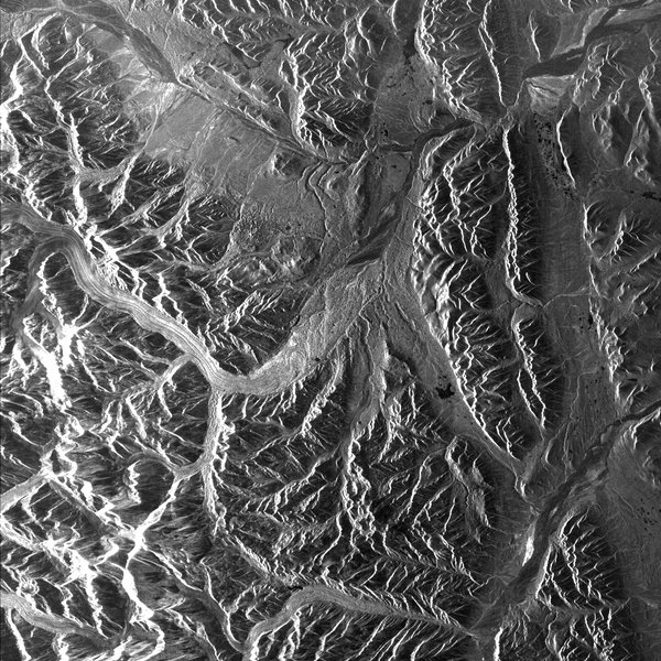
The scientific value of Seasat’s SAR is extensive, providing unique and unexpected views of the dynamic ocean surface and sea ice cover, as well as the vegetated, exposed, populated, and cold regions of Earth’s surface. ASF’s new suite of Seasat products are likely to be valuable in a range of scientific disciplines, particularly for studies that measure features of the planet’s surface over time. Examples include the following:
- Boreal forest land cover between 1978 and 1997 could be compared using data from Seasat and the Japanese Earth Resources Satellite 1 (JERS-1).
- Rates of deformation over known active faults in North America and Pacific Rim volcanoes could be studied using Seasat’s seven orbit cycles of 3-day repeat data.
- Glacial change observations based on data acquired in 1978 over Norway and Alaska could establish a much older baseline than is currently available from other sensors.
In addition to SAR, Seasat satellite instruments included a radar altimeter, a scatterometer, a scanning multichannel microwave radiometer, and a visible/infrared radiometer.
Technical Specifications
Launch
Seasat was launched aboard the Atlas-Agena on June 26, 1978, from Vandenberg Air Force Base in California. The Seasat spacecraft itself weighed 2,300 kilograms.
The launch sequence of Seasat went smoothly. The satellite, called Seasat-1 in orbit, had established communications and deployed its solar panels as well as sensor antennas during the second and third orbits. It then extended its synthetic aperture radar antenna.
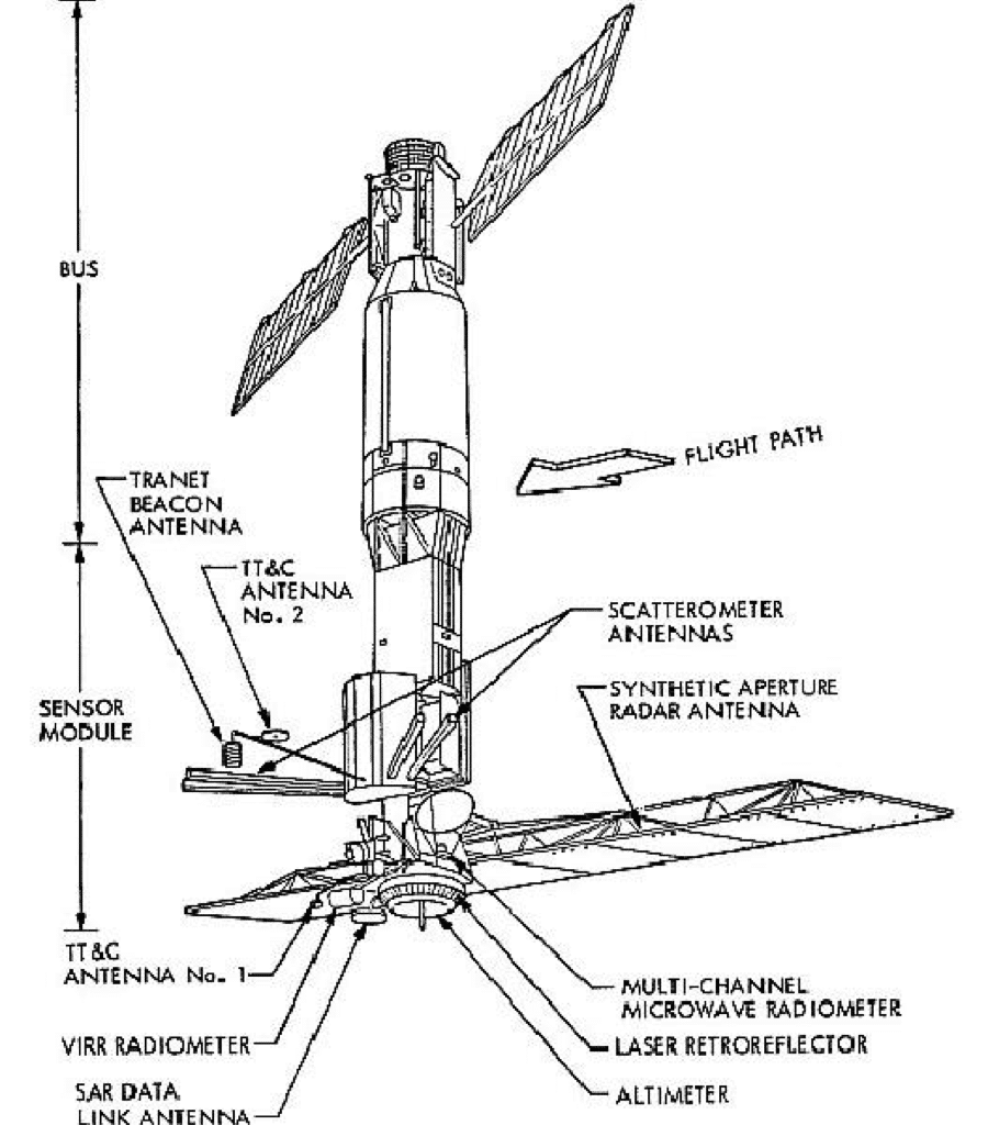
Illustration of the deployed Seasat spacecraft on orbit (image credit: NASA)
Sensors
Seasat’s five onboard sensors were individually managed by the following centers:
- Radar altimeter: Wallops Flight Center
- Scanning Multichannel Microwave Radiometer (SMMR) and Synthetic Aperture Radar (SAR): Jet Propulsion Laboratory
- Seasat-A Scatterometer System (SASS): Langley Research Center
- Visible and Infrared Radiometer (VIRR): Goddard Space Flight Center
Synthetic Aperture Radar
The SAR instrument onboard Seasat weighed 147 kilograms and consumed approximately 216 watts of power (1000 watts peak). As such, the SAR sensor could only be operated for 10 minutes per orbit, resulting in a total of approximately 42 hours of SAR data being recorded over the 106-day lifetime of Seasat.
The planar SAR antenna array consisted of eight, 1.3 m x 2.16 m, rigid and structurally identical fiberglass honeycomb panels. The panels were hinged together in series but were individually supported by a deployable tripod substructure that governed the deployment of the truss and provided the interface of the antenna structure with the spacecraft. The Seasat SAR sensor is regarded as the first imaging SAR system used in Earth orbit.
Originally, Seasat SAR data were optically processed into survey data products available on 70 mm film. Approximately 10 percent of the total Seasat SAR dataset was digitally processed by the Jet Propulsion Laboratory (JPL) from 1978 and 1982. Those digitally processed products contained complete 100-km-wide swaths of data.
Seasat did not have an onboard recording capability for data. Therefore, the received SAR echoes were downlinked in real-time to five ground receiving stations: Goldstone, California; Fairbanks, Alaska; Merritt Island, Florida; Shoe Cove, Newfoundland; and Oakhanger, United Kingdom. The SAR data were transmitted from the satellite to the ground stations in a 20 MHz analog data stream.
| Parameter | Value |
|---|---|
| Satellite Altitude | 800 km |
| Radar Center Frequency | 1.275 GHz (L-Band) |
| System Bandwidth | 19 MHz (linear FM) |
| Pulse duration | 33.4 us |
| Antenna Dimensions | 10.74 m x 2.16 m |
| Ground incidence angel | 23°± 3° cross track |
| No. of looks | 4 |
| Swath Width | 100 km |
| Data recorder bit rate (on the ground) | 110 Mbits/s (5 bits/word) |
| Radar Wavelength | 23.5 cm |
| Pulse Repetition Frequency (PRF) | 1463-1640 Hz |
| Polarization | Horizontal transmit, horizontal receive (HH) |
| Antenna Look Angle | 20° from vertical (fixed) |
| Antenna type | 1024-element passive micro-strip based arrays antenna, linearly polarized |
| Pixel Size | 25 m azimuth x 25 m range |
| Transmitted peak power | 1 kW |
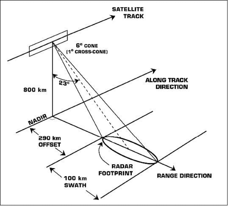
Illustration of the Seasat SAR viewing geometry (image credit: NASA/JPL)
