

Washington-Oregon coast: optically processed in 1982
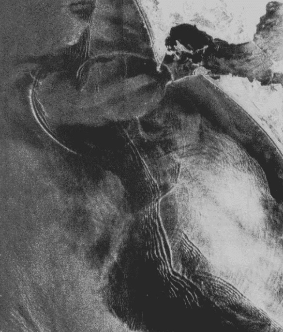
Acquisition date: August 19, 1978
Processing organization: JPL
NASA/JPL
Washington-Oregon coast: digitally processed in 2013
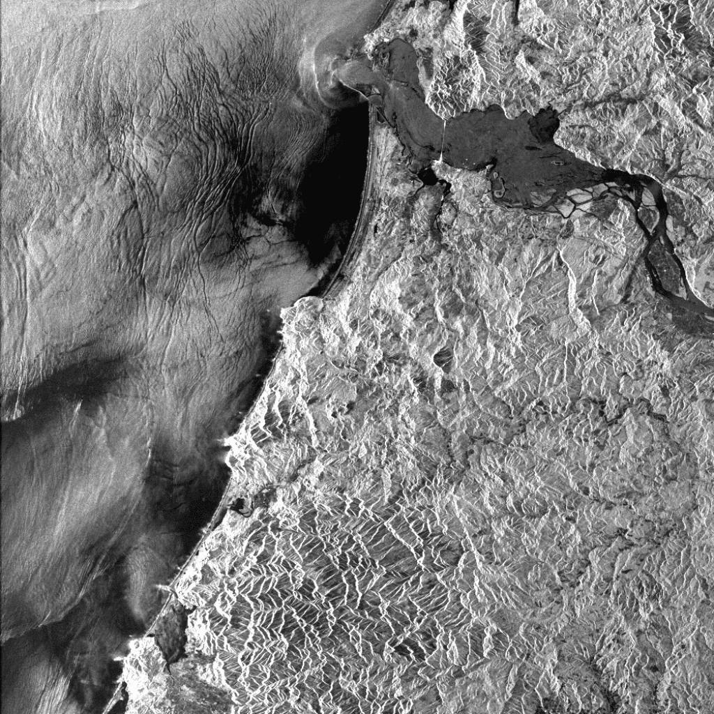
Acquisition date: August 10, 1978
Processing organization: ASF
NASA/JPL
These images, acquired nine days apart, both show the influence on wave patterns of a subsurface sediment spit near the mouth of the Columbia River between Oregon and Washington. The river is one of the largest in the world without a delta. The optically processed image to the left was acquired from Fu, L.-L., and B. Holt, “Seasat Views Ocean and Sea Ice with Synthetic-Aperture Radar,” Publication 81-120, Jet Propulsion Laboratory, Pasadena, Calif., 1982.
Kuskokwim Delta: digitally processed in 1987
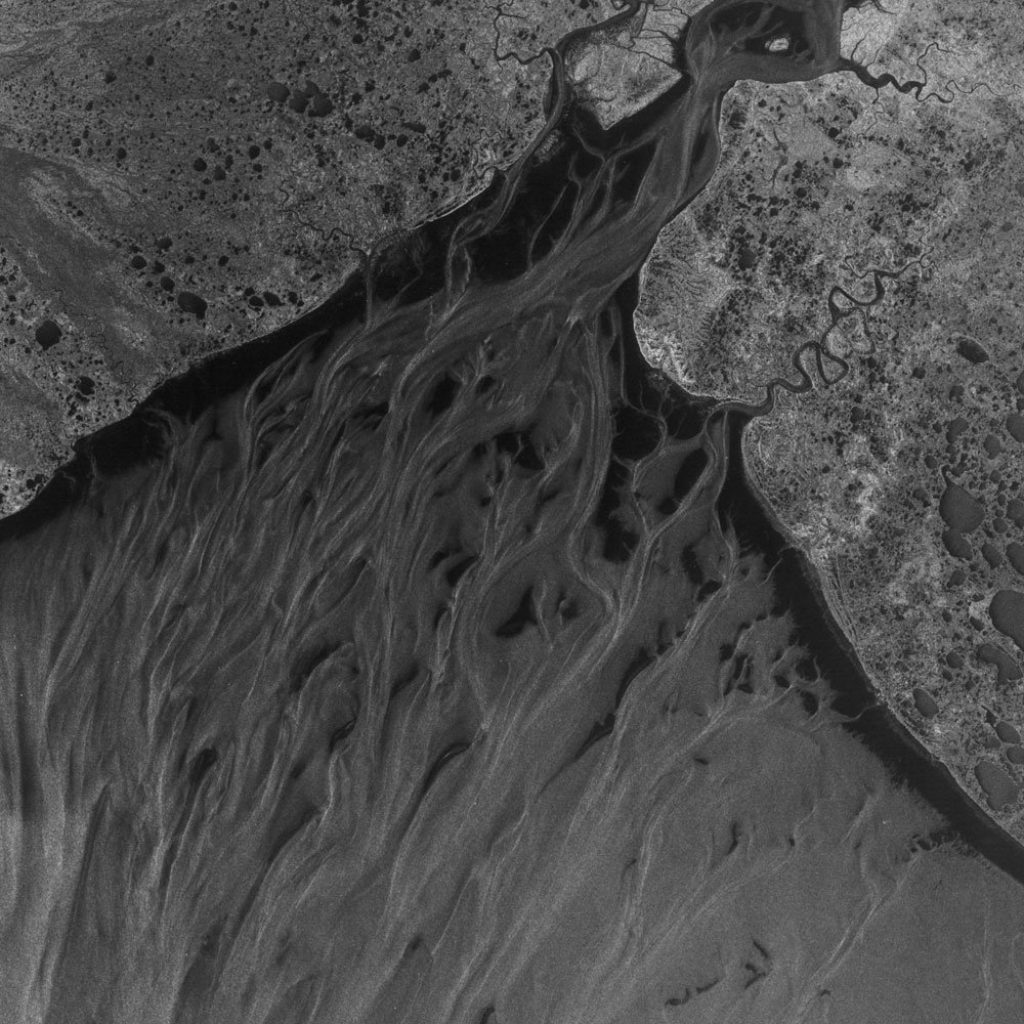
Acquisition date: August 19, 1978
Processing organization: JPL
NASA/JPL
Kuskokwim Delta: digitally processed in 2013
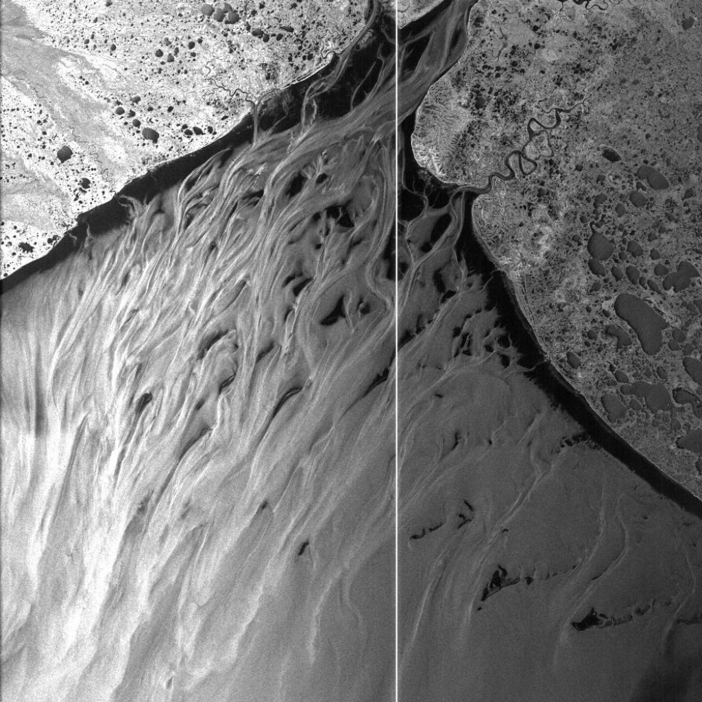
Acquisition date: July 13, 1978
Processing organization: ASF
NASA/JPL
Two Seasat SAR images, digitally processed 26 years apart, highlight advances in digital processing techniques and data storage technology. These advances allow more Seasat data to be processed and readily available for quantitative analysis to users around the world. The white line in the image to the right is from a calibration pulse.
