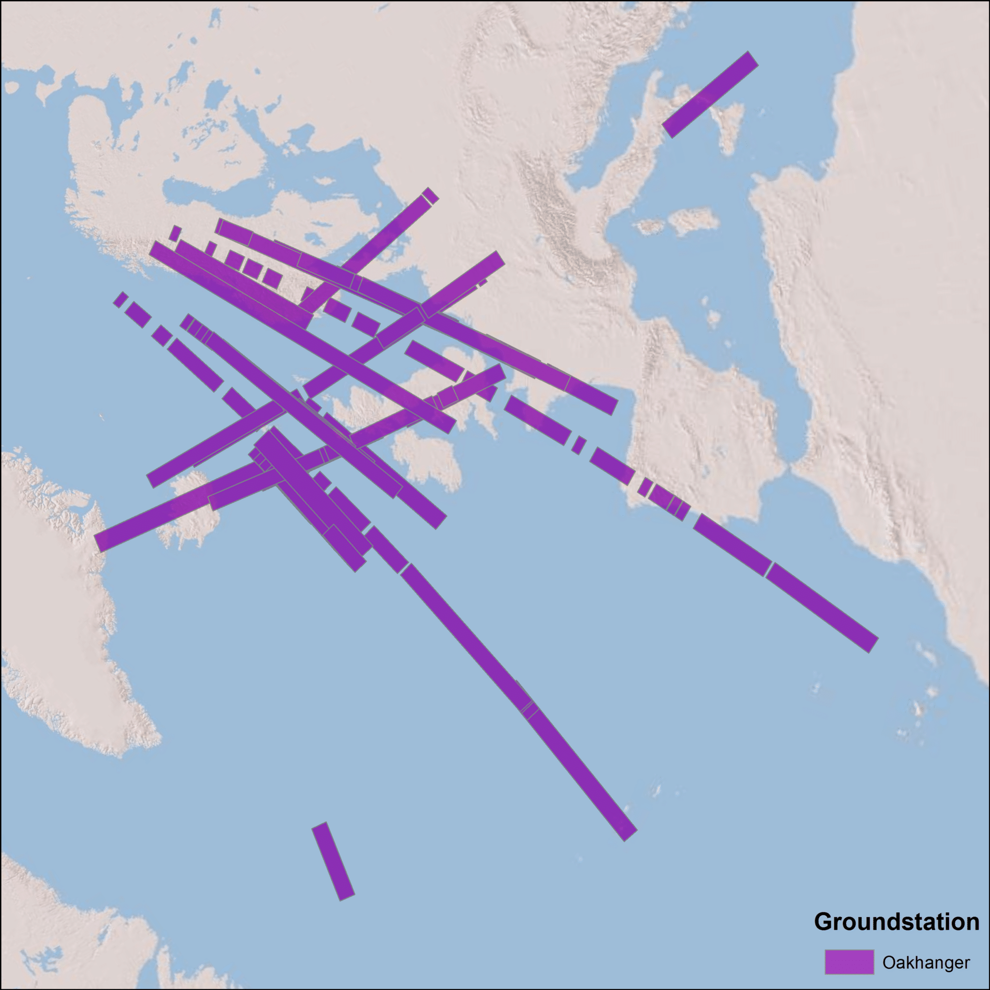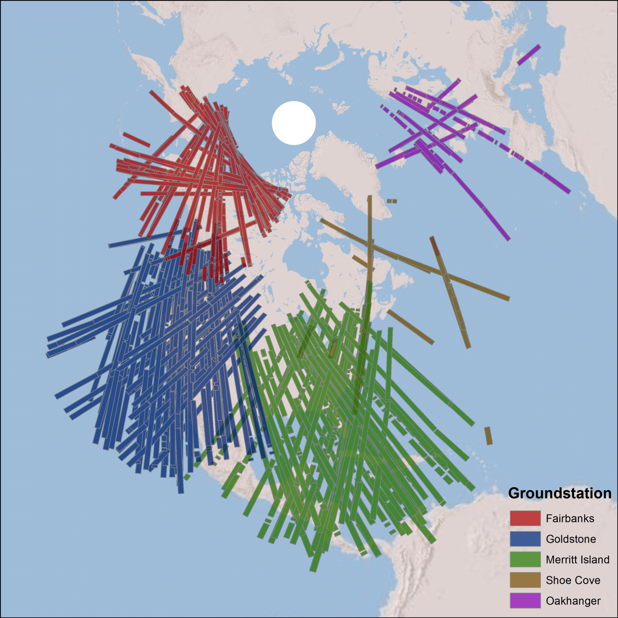
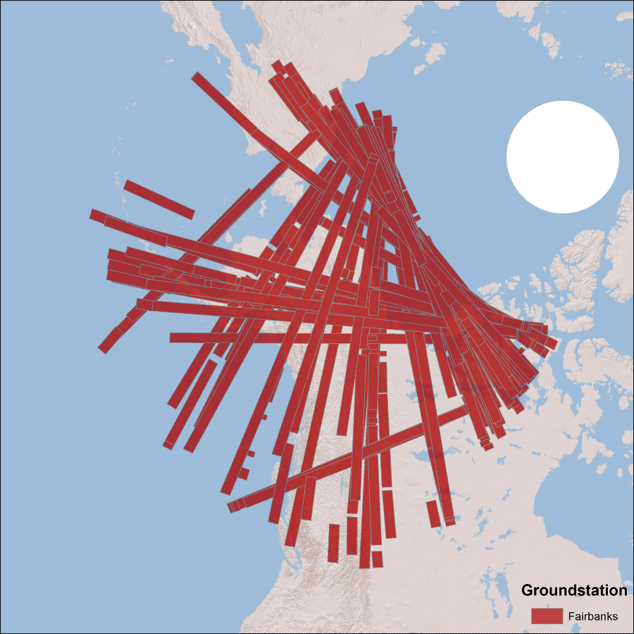
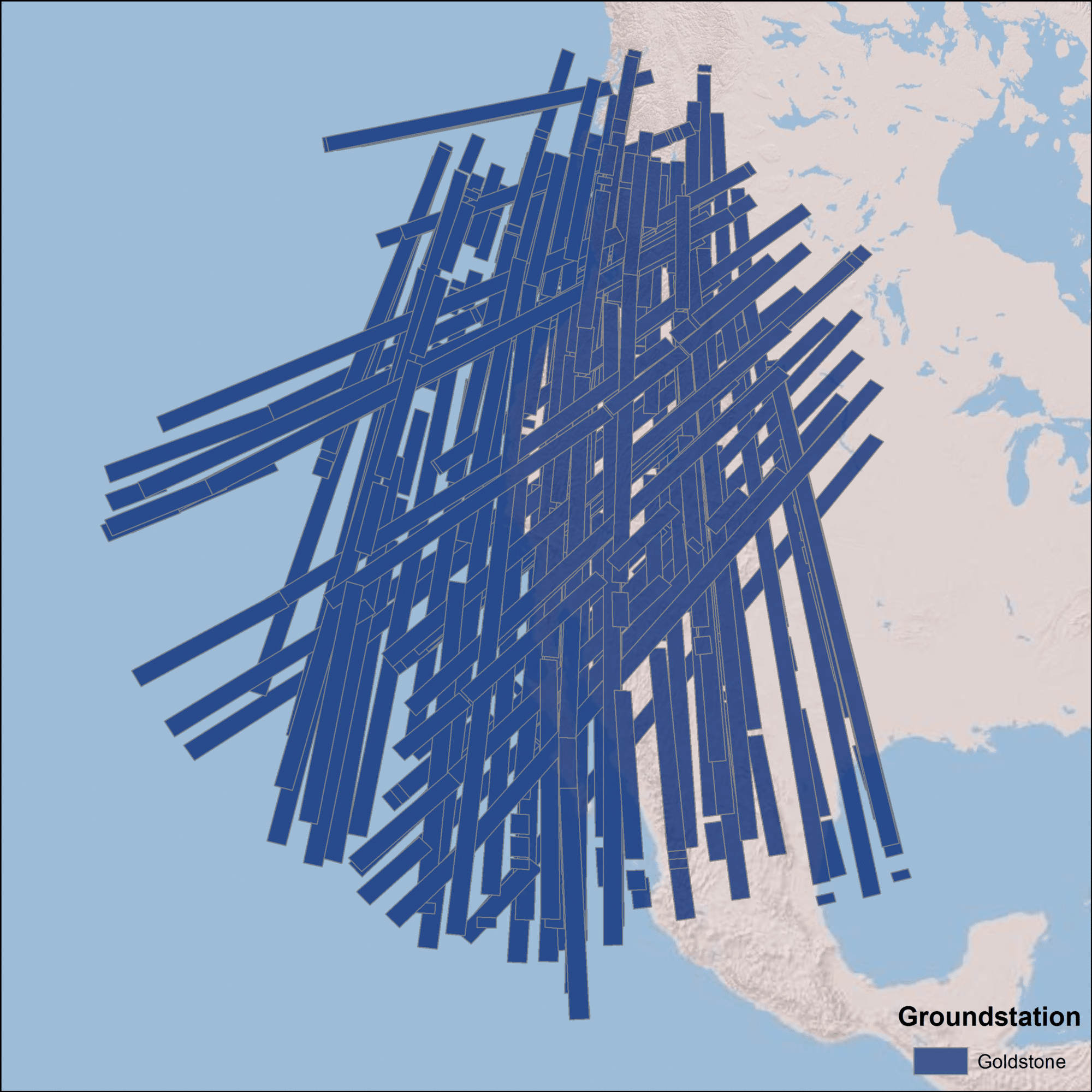
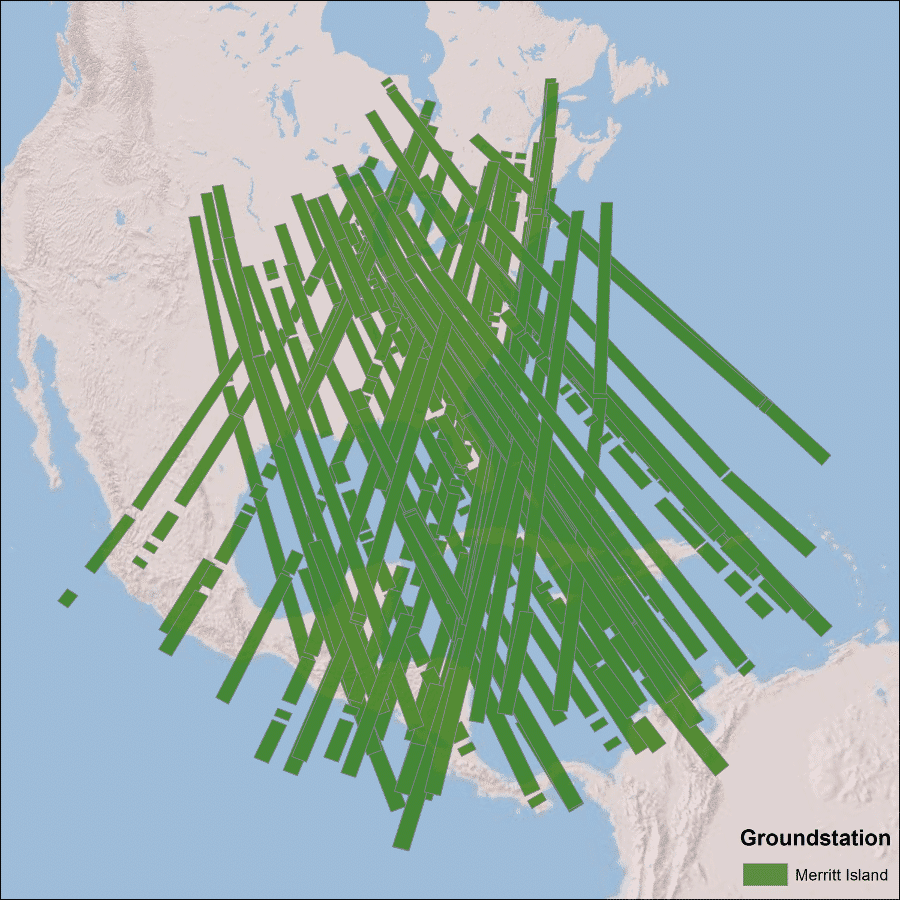
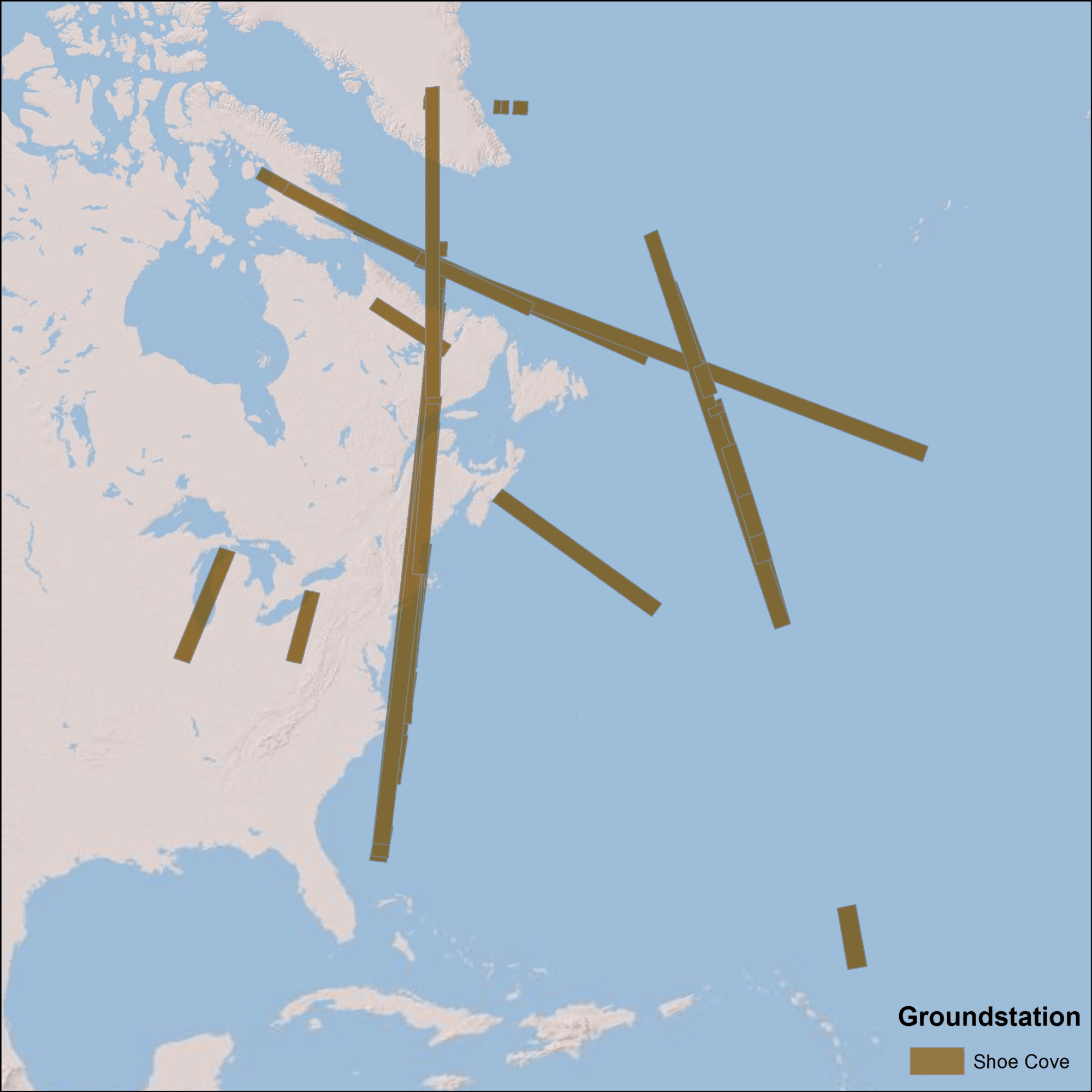
The coverage map above displays the location of Seasat products that have been processed by the ASF DAAC. Note: All Seasat frames undergo visual inspection, so frames displayed in the above map may not be immediately available for search and download via Vertex.
The orbit of the Seasat satellite was designed to allow coverage of areas up to 75 degrees north latitude. Seasat data was acquired by five ground stations in the Northern Hemisphere:
Fairbanks,
Alaska
Goldstone,
California
Merritt Island,
Florida
Shoe Cove,
Newfoundland
Oakhanger,
United Kingdom