

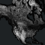
The Global Seasonal Sentinel-1 Interferometric Coherence and Backscatter (GSSICB) dataset provides a unique perspective of changes in seasonal global coherence and backscatter values measured using repeat-pass Sentinel-1 synthetic aperture radar (SAR) single-look complex data. The dataset was derived from satellite observations made over a one-year period, 2019-2020, and includes seasonal coherence and backscatter measurements covering most land masses from 82 degrees north to 78 degrees south latitude.
GSSICB data are publicly available from ASF and the AWS Registry of Open Data. To facilitate use of the data, ASF has created image services for some of the dataset products, and these can be accessed by any web mapping application or GIS software that supports ArcGIS Image Services or WMS layers. A separate service is published for each season and polarization of each data type.
Heidi Kristenson of ASF has created a StoryMap tutorial that explains where the GSSICB image services may be accessed and demonstrates, through interactive examples, the use of the different image layers available. Some basic concepts of SAR and SAR interferometry are also provided, which are helpful in image interpretation.
Learn more about the Sentinel-1 Interferometric Coherence and Backscatter Image Services through the interactive StoryMap:
https://storymaps.arcgis.com/stories/1d134497e47a47fda5ff2ddf05ec0015
Visit the ASF website to learn more about the GSSICB dataset and download products:
https://dev.asf.alaska.edu/datasets/derived/global-seasonal-sentinel-1-interferometric-coherence-and-backscatter-dataset/